
Waxhaw ZIP Code Coverage
The verified standard delivery ZIP for Waxhaw is 28173. It is a postal marker, not a line around the Town of Waxhaw. USPS identifies the Waxhaw Post Office with 28173, while town planning cautions that an address using Waxhaw as its mailing city may still be outside present town limits. Use 28173 to begin a ZIP code directory search, then use the exact address when the result will be compared with a parcel or town record.
| ZIP | Areas Covered | Post Office | Notes |
|---|---|---|---|
| 28173 | Waxhaw postal city and standard delivery addresses verified through USPS | Waxhaw Post Office | Primary Waxhaw delivery ZIP; never treat it as proof of town limits. |
| 28112 | Monroe and portions of Union County | Monroe postal geography | Nearby context, not a Waxhaw town label. |
| 28108 / 29720 | Mineral Springs and Lancaster-area postal context | Address-specific USPS verification required | Do not describe either as a Waxhaw delivery ZIP. |
Indian Trail 28079, Matthews-area 28104, and Wingate-area 28174 also appear in surrounding regional context. The research did not identify a public boundary data set that settles every edge address or future ZIP change. For that reason, nearby labels belong in a comparison, not in a list of Waxhaw ZIPs.
Waxhaw ZIP Code Post Office Details
The USPS Waxhaw Post Office record lists 100 Waxhaw Parkway, Waxhaw, NC 28173-9026, phone 704-843-3483, retail hours Monday through Friday from 9:30 a.m. to 5 p.m., and Saturday from 9:30 to 11:30 a.m. The office is closed Sunday. Its PO Box access is available around the clock, and General Delivery is listed as a service.
The post-office record answers a service question. It does not identify people at a delivery address or decide municipal jurisdiction. Keep the date of the postal result with the exact address, especially when an older deed, permit, or directory uses a different mailing form.
Use the USPS ZIP Code Lookup for the specific address before relying on a ZIP in a Waxhaw ZIP code directory search.
USPS ZIP Code Lookup shows the address-based verification route used for Waxhaw ZIP code directory work.
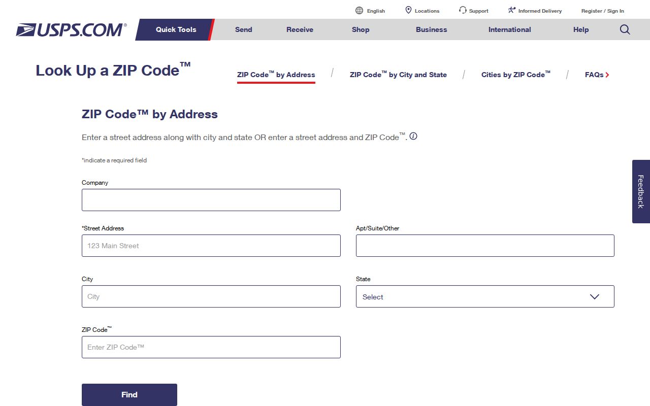
The USPS form asks for a street address, city, and state, so its returned ZIP should be saved as a delivery result for that address rather than generalized to a whole neighborhood.
Waxhaw ZIP Code Directory Terms
Postal terms look similar but serve different functions. A record may show a five-digit ZIP, a more precise delivery add-on, or a mailing arrangement that cannot be turned into a parcel boundary. Reading those fields correctly prevents a ZIP code directory from being mistaken for a municipal roll.
- ZIP Code
- A five-digit postal delivery geography. For Waxhaw, 28173 is the verified standard delivery ZIP.
- ZIP+4
- The added four digits refine delivery sorting for a specific address or segment. They do not create a separate town boundary.
- PO Box ZIP
- A postal code used for box service. It describes mail handling, not a home or parcel location.
- Unique ZIP
- A code assigned to a single organization or large receiver when USPS uses that arrangement. None was identified in the research as a Waxhaw residential geography.
- Carrier route
- A delivery-routing grouping used by the Postal Service. It is not a list of households and is not a town-limit layer.
USPS can validate the postal portion of an address. County mapping and recorded instruments answer different questions. Treat each label as dated evidence from its own custodian.
Checking a Waxhaw ZIP Code Address
Start with USPS, then move to the county record rather than trying to search deeds by ZIP. Union County's address-first route is the Union Real Property Search. Its public landing page offers Parcel, Address, and Owner fields. An address result can provide the physical address, parcel ID, displayed owner, market value, property use, legal description, sales history, and permit fields when populated.
| Field | How it helps with an address check |
|---|---|
| Address | Connects the postal form to the county parcel card. |
| Parcel | Supplies the PID used to compare GIS, tax, and deed references. |
| Owner | Offers a tax-recorded owner name, not proof of a current occupant. |
| Map layers | Provide parcel and FEMA context; a county map is not a survey. |
Record the address spelling, PID, source date, and portal timestamp. A trust or entity can appear as owner, and county data may lag a transfer. Those limits matter more than a broad ZIP label.
Union Real Property Search displays the address, owner, and parcel entry points used after a Waxhaw postal check.
The result path preserves the address-to-PID bridge that a name-based deed index does not provide by itself.
Finding Waxhaw Records by ZIP Code
A ZIP narrows the geography, but it does not produce a complete current resident list. Use it to confirm an address and map the relevant parcels. Voter data has its own statutory access rules, and the public voter lookup searches a person by name rather than a ZIP-only field. North Carolina allows some voter-file and selective list products through the elections offices, but protected information remains excluded.
- Enter the full street address in USPS ZIP Code Lookup and save the returned delivery city and ZIP.
- Use the same address in Union Real Property Search to record the PID and the parcel-card timestamp.
- Open UC Atlas and enable the ZIP, parcel, address-point, and other relevant public layers.
- When civic jurisdiction matters, compare the parcel with the town-limit map or MegaMap rather than assuming the ZIP settles it.
- For a name-based voter question, use the state lookup or request route with the required legal fields and preserve the result date.
After a ZIP has narrowed an address, the Waxhaw streets reference is the appropriate place for the fuller address-by-address record trail.
Waxhaw ZIP Code Layers in UC Atlas
UC Atlas is Union County's official mapping application. It supports parcel searches, complex queries, table and map exports, and layers that include ZIP codes, address points, polling sites, zoning, imagery, highways, drainage basins, and FEMA information. Parcel updates are ongoing, address points are updated daily and generally online the next day, and zoning is generally updated within about a week. FEMA data can be older.
County GIS says its maps are for tax and mapping purposes, not a legal land description or survey. The platform replaced GoMAPS on July 21, 2025, so a broken saved GoMAPS link is not evidence that a ZIP or town boundary changed. Record the active layer and imagery vintage used for any comparison.
UC Atlas provides the official parcel and ZIP-layer context for a Waxhaw ZIP code directory review.
Viewing the ZIP layer beside parcel and address points makes the postal geography visible without treating the screen boundary as a survey line.
Note: Preserve the map access date because updated parcel, address, and zoning layers may change after a search is saved.
Waxhaw ZIP Codes and Town Limits
Postal city, municipality, county, and voting jurisdiction are separate fields. Waxhaw Planning specifically warns that a Waxhaw mailing address does not necessarily put the parcel within town limits. For an edge address, USPS verifies delivery, UC Atlas supplies parcel and layer context, and the town-limit map or MegaMap is the municipal check. The county may serve an unincorporated parcel even when the postal city says Waxhaw.
When an address itself needs correction or clarification, Union GIS links a New Address Request, while town planning and permit staff can explain municipal addressing and jurisdiction. The Register of Deeds supplies the recorded legal description, not the delivery ZIP. County Assessor, GIS, and Register of Deeds counters, their published phone or email routes, and a defined public-record request remain available when the online tools do not settle the record question.
Keep three dates. Preserve the USPS result date, the parcel or GIS timestamp, and the date on any deed, permit, or historical directory. They can describe the same address at different points in time.
That distinction is useful for zoning, permit, polling, and historical research. It also prevents a postal label from being used as a claim about a person's residence or civic status.
Waxhaw ZIP Code Labels in Older Records
Modern ZIP codes do not translate cleanly into older local sources. Union County formed in 1842, Waxhaw was chartered in 1889, and the verified Monroe and Union County directory volumes span 1922-23, 1942-43, 1951-52, 1955-56, 1958-59, and 1962-63. Those printed records can show names, streets, household notation, and business details, but they should be cited by page and year rather than retrofitted with a modern ZIP.
The comparison is especially useful on Waxhaw Road. The 1958-59 criss-cross material calls it a continuation of West Franklin beyond the city limit. That is a historical street clue, not proof of a current Waxhaw boundary. Read symbols and parenthetical numbers against the directory key before assigning meaning.
The Union County Library's Dickerson Room, Southwest Regional Library, the Museum of the Waxhaws, and the NC State Archives are the fallback chain for older local context. The Archives copy form accepts targeted county, year, person, and record-series requests. Its county guide is especially useful when an old land, court, estate, tax, election, or map record has no modern ZIP field.
Note: A historic mailing label, current parcel record, and current delivery ZIP can each be accurate for different dates.
Waxhaw ZIP Code Privacy Limits
A delivery ZIP does not disclose a household roster. North Carolina voter data excludes full and partial Social Security numbers, dates of birth, driver-license numbers, and protected agency or address fields. The NC Department of Justice Address Confidentiality Program also provides substitute-address protection for eligible survivors. Parcel and voter information must never be combined to expose a protected location.
If a county or town record is unavailable online, make a narrow request under G.S. 132-6 and identify the custodian, record type, date range, address or PID, desired format, and a fee-estimate request. G.S. 132-6.2 permits a request for an available medium but does not require an agency to create a new record.